


GPS Geotag Photos & Camera Map
2.938.00 Reviews
App Specs
- Version
- 70.0
- Updated On
- License
- Free
- Downloads
- 1,000,000+
- Developer
- NguyetDev
- Categories
- Photography
- Platform
- Android
Screenshots
 Analysis by AppCompare
GPS tags are most useful when they answer a question you would otherwise forget to ask: where, exactly, did I take this picture? That small detail can turn a folder of similar-looking travel shots into a record you can browse by place. GPS Geotag Photos & Camera Map is a free photography app from NguyetDev, built around adding location information to pictures. I see its strongest appeal in the simple link between a photo and the spot where it was made, rather than in elaborate editing.
A location stamp changes how a photo ages
A landscape can be memorable while its name escapes you; a café, trail entrance, or viewpoint may be hard to identify weeks later. A location stamp gives the image useful context without relying on your memory or a handwritten note. That is especially handy when several photos from a trip have similar light, scenery, or architecture.
The practical value is less about making a picture look different and more about making it easier to understand later. When I sort through a camera roll, I want a quick clue that connects an image to a place. Geotagging can provide that clue, although it is worth remembering that a location attached to a photo is useful only if it was captured accurately and is appropriate to share.
Capture with Precision
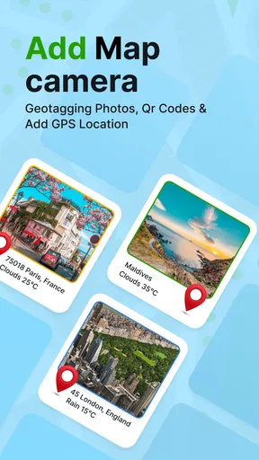
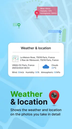
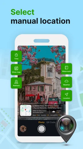
One of the coolest features of this app is how effortlessly it tags your photos with precise GPS coordinates. It’s as if every picture you take comes with its own little map. The app runs smoothly in the background, so you don’t have to fiddle with settings or worry about missing the moment. Just snap away!
Making the location useful in practice
For a dependable travel record, I would check that location access is available before starting a walk or day trip, then take a test photo somewhere easy to recognize. That gives me a chance to see whether the stamp is helpful before I have a whole set of images to sort through. In a place with tall buildings, indoors, or under heavy cover, I would treat the position as a guide rather than a survey-grade marker.
A useful habit is to take one establishing photo when arriving somewhere and then use ordinary pictures for the details: the meal, a sign, or a view from a particular path. The first image gives the day a geographic anchor, while the rest preserve the moments. This workflow is more helpful than expecting every frame to explain the whole outing on its own, and it makes a location-stamped collection easier to scan later.
There is also a privacy trade-off that is easy to overlook. A precise tag can be helpful in a personal archive but may reveal a home, a child’s regular activity, or a secluded place if the image is shared publicly. I would review location information before posting sensitive photos and keep geotagging for pictures where the place is part of the story. The convenience is real, but so is the responsibility that comes with attaching a real-world location.
Worth Reading Before You Choose

EA SPORTS FC Mobile 26 Is a Bigger Football Game, but It Takes Time

Flipboard Shows What News Apps Must Do Beyond the Feed

Switching to Android Auto Means Rethinking Your Driving Routine

Google Calendar Makes a Crowded Week Easier to Manage

Ludo King Makes the Most of the Minutes Between Plans

Baby Panda World Brings Quick Play to Modern Phones, but Its Game Library Feels Busy
Explore and Relive
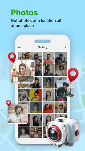
Once you’ve got your photos, the fun doesn’t stop. The GPS Geotag Photos & Camera Map lets you view your images on a map, creating a visual journey of your travels. Imagine scrolling through your gallery and seeing pins drop on all the places you've visited. It’s a fantastic way to relive memories and share your adventures with friends and family.
A realistic day out with mapped photos
Picture a weekend visit to a town you do not know well. You take pictures at the station, stop for lunch, wander to a riverside path, and finish at a viewpoint. Without location context, those images may become a pleasant but jumbled sequence in your camera roll. With location stamps, you have a better chance of connecting each scene to its place when you revisit the photos later.
That can also make practical planning easier. If you are considering returning, the images can remind you which stretch of the walk had the best view or where you found a particular shop. I would not rely on a photo stamp as turn-by-turn guidance, though: it records context for an image, not a substitute for a dedicated navigation tool or a written address when exact directions matter.
Where it sits among photo tools
Most phone cameras already make it easy to take and browse pictures, and many people are satisfied with the ordinary gallery view. A dedicated geotagging workflow makes more sense when location is a key part of how you want to remember or organize a collection. It serves a different purpose from a photo editor: the value is the place attached to the image, not filters, retouching, or creative effects.
It is also not the same as keeping a travel journal. A journal lets you explain why a place mattered, while a location stamp gives a compact geographic clue. For a richer record, I would pair selected geotagged photos with a short note about the route, event, or person in the frame. That combination is more informative than asking a map pin to carry the whole story.
Easy Integration
You might be wondering, "How do I get these geotagged photos off my phone?" Don’t worry, the app has got you covered. It integrates seamlessly with platforms like Google Photos and Dropbox, making it simple to store and share your images. Plus, you can export your data in various formats, perfect for creating detailed travel logs.
What to check before depending on it
If your main question is whether the location is included in the photo or simply shown while browsing, the distinction matters: embedded location information can travel with a file, while a map view may depend on the app or gallery used to open it. Before building a long-term archive, I would test one image by moving or sharing it the way I normally do, then check what information remains visible. That quick trial helps avoid surprises later.
I would also keep a second way to remember places that matter. A short note with a landmark or street name can rescue an image if a location reading is imprecise or a later app does not display it as expected. The stamp is most useful as a low-effort memory aid, not as the sole record for professional fieldwork, property documentation, or anything where exact positioning has serious consequences.
GPS Geotag Photos & Camera Map is rated 2.9 on average from around 1,400 ratings, so I would approach it with measured expectations rather than assuming every user’s experience will be the same. It has more than a million installs, is rated for Everyone, and its current version is 70.0; it supports Android 7.0 and later. Those details make it easy to consider as a free option, but I would still test the basic capture-and-review routine before depending on it for an important trip.
Who gets the most from it
For someone who travels, hikes, visits unfamiliar neighborhoods, or photographs locations for personal reference, the appeal is straightforward: less guessing when looking back. It is especially useful if you take many pictures in one day and tend to forget which street, park, or viewpoint each one shows. A casual photographer who mainly takes portraits at home may get little from adding location context to every shot.
I would skip this approach if you want a full editing suite, a detailed route tracker, or a guaranteed record of exact coordinates for formal work. A standard camera and gallery are simpler when you rarely search by place; a dedicated mapping or navigation app is a better fit when directions or route logging are the priority. The right choice depends on whether you want to remember where a photo was taken, rather than do something more demanding with the location.
Who’s It For?
Whether you’re a travel blogger, a professional photographer, or just someone who loves capturing memories, this app is a game-changer. It’s perfect for those who enjoy organizing their photos in a way that tells a story. Say goodbye to wondering "Where was that picture taken?" and hello to a beautifully mapped-out photo journey.
For a blogger or working photographer, I would treat it as a supporting tool, not a replacement for a careful file-management routine. Before publishing, check whether the location should remain attached, and keep a separate note for client names, permissions, or other details a coordinate cannot explain. For family albums, the balance may be different: a familiar park or holiday stop can add welcome context, while a private home address is better left out of public posts.
My take after weighing the trade-offs
Overall, if you love traveling and photography, this app is a must-have in your toolkit. It’s intuitive, reliable, and adds a whole new dimension to how you view your adventures. So, next time you’re planning a trip, make sure you’ve got GPS Geotag Photos & Camera Map ready to go!
My recommendation is more specific: try it if place is part of the memory you want to keep, and judge it with a small batch of photos before making it central to your routine. Its best contribution is modest but practical—helping a picture retain a sense of where it belongs. If your priority is editing, navigation, or sensitive location handling, another tool or a more manual workflow may suit you better. For everyday travel photography, though, that extra geographic context can make a camera roll feel much less anonymous.
Pros
- Easy geotagging of photos.
- User-friendly interface.
- Real-time map updates.
- Offline map capability.
- Supports multiple photo formats.
Cons
- Consumes significant battery.
- Limited free version features.
- Occasional GPS inaccuracies.
- No cloud backup integration.
- Ads in the free version.
FAQs for GPS Geotag Photos & Camera Map
What is the primary function of GPS Geotag Photos & Camera Map?
GPS Geotag Photos & Camera Map allows users to add geolocation data to their photos. This means each photo is tagged with the specific location where it was taken, using GPS data. This feature is particularly useful for travelers and photographers who want to organize their images based on geographic locations.
Does GPS Geotag Photos & Camera Map work offline?
Yes, GPS Geotag Photos & Camera Map can function offline to some extent. While the app can still tag photos with location data from previously stored GPS coordinates, it requires an active internet connection to access live map features and update location data accurately when on the move.
What are the key benefits of using GPS Geotag Photos & Camera Map?
The app provides several benefits, including the ability to organize photos geographically, enhance travel documentation, and integrate seamlessly with social media platforms for sharing location-tagged images. Additionally, it offers intuitive map views and easy navigation, making it a valuable tool for avid travelers and photographers.
Is GPS Geotag Photos & Camera Map user-friendly for beginners?
Yes, the app is designed with a user-friendly interface, making it accessible for beginners. It offers straightforward navigation, clear instructions, and helpful tutorials. Users can easily learn how to geotag photos and navigate through various features without requiring extensive technical knowledge.
Are there any privacy concerns with using GPS Geotag Photos & Camera Map?
Privacy is a valid concern when using geotagging apps. GPS Geotag Photos & Camera Map provides options to manage privacy settings, allowing users to control what data is shared and with whom. It’s important to review these settings and understand how location data is used, ensuring personal information remains secure.


